
TL;DR
- Bhu-Naksha is the National Informatics Centre (NIC) cadastral mapping system, deployed state-by-state at addresses like
bhunaksha.<state>.gov.in; you pick state, district, taluk/tehsil and village, then click a survey/plot number to see its boundary, sub-divisions (hissas), area and land class on a map — useful to check shape, extent and overlaps before you buy, read against the recorded RTC/RoR. - It is a viewer, not a title document. The sketch is labelled "indicative only" — proportions and angles are approximate, you cannot measure distances from it, and it does not prove ownership.
- The map base is mostly digitised from old (often 1960s) chain-and-rope surveys, so it can drift from GPS ground reality and from a registered sale plan; treat it as a cross-check, never as a substitute for the textual record or a licensed surveyor.
- Karnataka does not run a standard
bhunaksha.karnataka.gov.in; the same cadastral-on-satellite view is delivered through KSRSAC's Dishaank app and the SSLR/Bhoomi map services, with the textual RTC alongside. - The diligence value is the overlay: when the map shape, the RTC extent and the registered deed all agree, your survey number is consistent; when they disagree, you have found a question worth answering before payment.
What is Bhu-Naksha?
Bhu-Naksha is a free, public web application built by the National Informatics Centre (NIC) that lets you view the cadastral map — the official plot-boundary map — of a survey number, state by state. "Bhu" means land and "naksha" means map. You navigate down a geography (state, district, taluk or tehsil, village), and the system draws the village's survey grid; click a parcel and it highlights that plot's outline, its sub-divisions, its area and its land classification, usually with a link or button to pull the textual record of rights.
A common misconception: Bhu-Naksha is not a title document and not a survey certificate. It is a digitised map layer plus a viewer. It tells you what a parcel is shaped like and where it sits in relation to its neighbours — it does not, by itself, tell you who owns it cleanly, whether it is mortgaged, or whether the boundary is accurate to the centimetre on the ground. For ownership you read the RTC / record of rights; for accuracy you commission a physical demarcation. Bhu-Naksha is the picture that should agree with those records.
Bhu-Naksha vs the textual record (RTC / RoR / 7-12)
| Bhu-Naksha (cadastral map) | Textual record (RTC / RoR / Patta) | |
|---|---|---|
| Shows | Plot boundary, shape, sub-divisions, area, land class | Owner name(s), extent, tenancy, crop, encumbrance column, mutation |
| Form | Map / sketch (PDF or on-screen) | Tabular extract |
| Good for | Checking shape, extent, adjacency, overlap | Checking ownership, area, charges, history |
| Legal weight | Indicative only — not for measurement or proof | The operative revenue record (still not a title guarantee) |
| Read it | Against the deed plan and the RTC | Against the deed and the encumbrance certificate |
Always read the two together. A clean RTC over a plot whose mapped shape does not match the registered sale plan is exactly the kind of contradiction a title search report exists to surface.

How do I view a cadastral / plot map by survey number?
The flow is broadly identical across the NIC Bhu-Naksha deployments. Use the official state government portal — avoid the many look-alike private sites that mirror the data.
- Open your state's Bhu-Naksha portal. Most states use
bhunaksha.<state>.gov.in(for example the Bihar, UP, Rajasthan, Odisha, West Bengal and Maharashtra deployments). If unsure, search for the state's revenue / land-records department site and follow its Bhu-Naksha link rather than typing a guessed URL. - Select the geography. Pick District, then Sub-division / Tehsil / Taluk, then Circle / Hobli, then Village (Mouza). The labels differ by state but the hierarchy is the same: state down to village.
- Choose the survey/map instance. Some states ask for a sheet number, map type or survey type at this point. The village map then renders on screen.
- Enter or click the survey/plot number. Type the survey number (or khasra / plot number) in the search box, or click the parcel directly on the map. The selected plot highlights.
- Read the Plot Info panel. A side panel shows the plot number, its sub-divisions, the area/extent, the land classification, and usually the owner reference. Use the "Plot Report", "Map Report" or "Nakal" button to generate a PDF of the bounded sketch.
- Cross-check the extent and shape. Compare the mapped area against the RTC/RoR extent and the schedule in the registered deed. Compare the shape and the adjoining survey numbers against the seller's sale plan.
What the output looks like
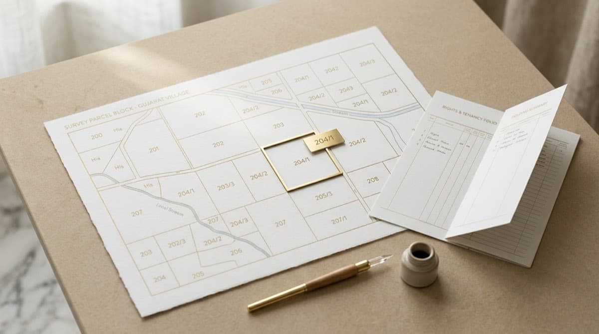
You typically get two things: an on-screen highlight of the parcel within its village grid, and a downloadable sketch (PDF) showing the plot outline with its survey number, sub-divisions and an area figure. The PDF is the "bounded sketch" or map report — handy to attach to a file note. Remember it is a reference sketch: the portals themselves state the proportions and angles are approximate and you should not scale distances off it.
Karnataka: where the cadastral map actually lives
Karnataka is a useful exception worth calling out, because developers searching for a Karnataka village cadastral map often expect a bhunaksha.karnataka.gov.in and do not find a conventional one. Instead, Karnataka delivers the same cadastral-on-satellite experience through the KSRSAC Dishaank app and the SSLR / Bhoomi map services. Dishaank superimposes the digitised 1960s village cadastral maps onto live satellite imagery and lets you search by district, taluk, village and survey number — or stand on the land and use GPS to identify the survey number under your feet. The textual side stays on Bhoomi RTC / Pahani, and the registered deed and encumbrance trail sit on Kaveri 2.0. The principle is identical to Bhu-Naksha elsewhere: the map is the visual cross-check against the text.
What can a Bhu-Naksha cadastral map actually tell you in diligence?
Used correctly, the cadastral map answers a specific set of geometry questions that the text alone cannot:
- Shape and extent. Does the plot's drawn outline and area match the extent on the RTC and in the deed schedule? A survey number recorded as a neat rectangle but mapped as an L-shape is worth a question.
- Sub-division (hissa) reality. Has the survey number been split? If you are buying "Sy. No. 45" but the map shows 45/1, 45/2, 45/3, you need to know exactly which hissa you are getting and that its boundary is the one in your deed.
- Adjacency and access. What sits next to the parcel — a road, a tank/lake bed, a drain, government (gomal/kharab) land? This is your first read on access and on whether part of the extent is unbuildable.
- Gross overlap and missing parcels. If your survey number does not render, or renders on top of a neighbour, that is an early signal of a digitisation error or a boundary dispute.
These checks map directly to the "Land" pillar of a developer's diligence. They belong on any property due diligence checklist precisely because a buyer who only reads the RTC can miss a geometry problem that the map makes obvious.
What a Bhu-Naksha map CANNOT tell you
This is the honest part, and it matters because the maps carry an official disclaimer for a reason.
- It is not legal proof and not measurable. The portals state the sketch is indicative; proportions and angles are approximate and it cannot be used for governmental or legal purposes or to settle a boundary in court.
- The base is old. Most cadastral data derives from chain-and-rope surveys of the mid-20th century. Re-surveys and GPS-grade re-mapping are still in progress in many districts, so the drawn boundary can differ materially from the true ground position.
- It does not show ownership cleanly, charges, or litigation. Owner reference aside, the map carries nothing about mortgages (CERSAI / registered deeds), pending court cases, or whether a mutation is contested.
- It will not catch a fabricated or stale record. If the underlying revenue entry is wrong, the map faithfully draws the wrong thing.
Because of all this, the map is a cross-check, not a verdict. The only way to settle a boundary on the ground is a physical demarcation by a licensed surveyor (in Karnataka, via the SSLR / "Mojini" process); the only way to settle title is the documentary chain a lawyer reviews and signs off on.
How does Bhu-Naksha compare across other states?
The viewer is national; the records it links to are state-specific. If you work across states, learn the local equivalent of "the RTC" and "the EC", because the Bhu-Naksha map is only half the picture.
| State | Cadastral map access | The textual record to read alongside |
|---|---|---|
| Karnataka | KSRSAC Dishaank app / SSLR map services | RTC (Pahani) on Bhoomi; deeds/EC on Kaveri 2.0 |
| Maharashtra | Bhu-Naksha / MahaBhunaksha | 7/12 (Satbara) and 8A; Property Card in cities |
| Telangana | Map layer via the state land system | Dharani / Bhu Bharathi ROR |
| Andhra Pradesh | Bhu-Naksha AP / FMB sketch | Adangal and 1B on Meebhoomi |
| Tamil Nadu | FMB / cadastral via the survey portal | Patta and Chitta; EC on TNREGINET |
| Most others (Bihar, UP, Rajasthan, Odisha, WB, etc.) | State Bhu-Naksha portal | State Bhulekh / RoR / khatauni |
The transferable, pan-India concepts are the same everywhere: a survey/khasra number identifies the parcel, the cadastral map shows its geometry, the record of rights shows ownership and extent, and a separate encumbrance search shows charges. Increasingly, a parcel also carries a ULPIN / Bhu-Aadhaar 14-digit ID that ties the map object to the textual record — when present, it is the cleanest way to be sure the map and the RTC describe the same piece of land.
Frequently asked questions
Is a Bhu-Naksha map legally valid proof of ownership or boundary? No. Bhu-Naksha is an indicative cadastral viewer. The portals themselves state the sketch's proportions and angles are approximate and that it cannot be used for legal or governmental purposes. Ownership is evidenced by the record of rights and the registered title chain; the precise on-ground boundary is fixed only by a physical demarcation done by a licensed government surveyor. Treat the map as a cross-check, not as proof.
How do I view a plot map by survey number? Open your state's official Bhu-Naksha portal (commonly bhunaksha.[state].gov.in), select district, then tehsil/taluk, then village, then enter or click the survey/plot number. The plot highlights and a side panel shows its sub-divisions, area and land class, with a button to download the sketch PDF. In Karnataka, use the KSRSAC Dishaank app or the SSLR/Bhoomi map services instead, since there is no standard bhunaksha.karnataka.gov.in.
Why does my survey number not appear, or appear in the wrong place, on Bhu-Naksha? Usually because the digitised base map is built from old (often 1960s) chain-and-rope surveys and has not yet been re-mapped to GPS accuracy, or because of a digitisation or mutation error after a sub-division. A missing or misplaced parcel is a red flag worth chasing: verify the survey number against the current RTC/RoR, check whether the survey number was sub-divided into hissas, and if it matters to a transaction, order a fresh survey from the land-records department.
What is the difference between Bhu-Naksha and the RTC / 7-12 / Patta? Bhu-Naksha is the map; the RTC (Karnataka), 7/12 (Maharashtra), Patta/Chitta (Tamil Nadu) or equivalent is the text. The map shows shape, extent, sub-divisions and adjacency; the textual record shows owner names, extent, tenancy/crop and the encumbrance column. They should agree. A mismatch between the mapped shape or area and the textual extent is one of the most useful things diligence can find before money changes hands.
Can Bhu-Naksha show mortgages or pending court cases on the land? No. The cadastral map carries only geometry and a basic owner reference. Active mortgages are found through CERSAI and registered-deed (encumbrance) searches, and litigation is found through eCourts, the relevant High Court and, for company-owned land, the NCLT. A complete picture combines the map, the record of rights, the encumbrance search and a litigation search — which is exactly what a four-pillar title search report assembles before a lawyer signs it.
Is the data on private Bhu-Naksha websites reliable? The data largely mirrors the government source, but for any decision use the official state portal or app. Private aggregator sites can be out of date, may not reflect the latest mutation or re-survey, and have no legal standing. For a transaction, pull the record from the official portal, note the date and reference, and have the map and textual records reviewed as part of formal diligence rather than relying on a screenshot.
Continue reading
How to Download a 7/12 (Satbara) Extract Online in Maharashtra — and 8A vs Property Card
8 min read
How to Check 7/12, 8A and Mutation Records on AnyROR Gujarat (VF-6/7/8A)
8 min read
How to Check Jamabandi Land Records Online in Haryana / Gurugram (Khewat, Khasra, Intkaal)
8 min read

Bhoomi RTC for Karnataka Land Acquisition: A Developer's Guide
11 min read
Automate your due diligence
Skip the manual portal work.
Deedwise automates everything in this article — across every connected portal — and delivers a complete Title Search Report in hours.
Request Access